
New paper: "From pixels to riverscapes: How remote sensing and geospatial tools can prioritize riverscape restoration at multiple scales"
Published on May 11, 2024
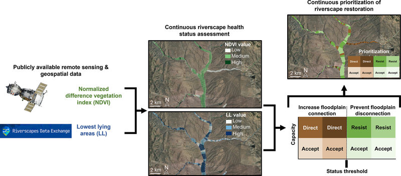
A new article published last month by Hayley Glassic and colleagues in WIREs Water highlights the use of remote sensing and RC models to inform the prioritization riverscape restoration at multiple scales. The article is open access.
Glassic, H. C., McGwire, K. C., Macfarlane, W. W., Rasmussen, C., Bouwes, N., Wheaton, J. M., & Al-Chokhachy, R. (2024). From pixels to riverscapes: How remote sensing and geospatial tools can prioritize riverscape restoration at multiple scales. WIREs Water, 11(3), e1716. https://doi.org/10.1002/wat2.1716